History
Climbing the Matterhorn: Whymper, the Hörnli Ridge and the Hut
For almost everyone who climbs the Matterhorn, the route is the Hörnli ridge above Zermatt, the line of the first ascent on 14 July 1865. It is a two-day climb: you walk up to the Hörnli hut at 3,260 m on the first day, sleep there, and set off before dawn for the 4,478 m summit. The hut itself says fit, experienced climbers usually reach the top in 4 to 5 hours, and that the way down is longer and harder than the way up.
It is a serious climb, not a hike. Local guides take one client per rope, ask which 4,000-metre peaks you have already climbed, and run the ascent from mid-July to mid-September when conditions allow. If you are not a climber, you can still walk to the Hörnli hut from Schwarzsee, watch climbers on the ridge through binoculars, and see the broken rope from 1865 in the museum in Zermatt.
The short answer
- Standard route: the Hörnli ridge from Zermatt, which is the Swiss normal route. The Italian normal route follows the Lion ridge from Breuil-Cervinia.
- Time: two days. Hut on day one; summit and descent on day two.
- Guide: Zermatt Tourism lists a mountain guide as necessary, and the hut always recommends one. Guides take one guest each.
- Season: best from the beginning or middle of July to the middle of September.
- Fitness: excellent endurance, good acclimatisation, and experience with crampons on mixed rock and ice.
- Danger: an estimated 500 climbers died on the mountain between 1865 and the end of the 2011 summer season, according to Zermatt Tourism.
The first ascent: 14 July 1865
By 1865 the Matterhorn was, in Zermatt Tourism’s words, the only remaining famous 4,000-metre peak still to be climbed. Monte Rosa, almost directly opposite, is almost 170 metres higher, but it was the Matterhorn’s steep, free-standing pyramid that had defeated everyone.
A race between two valleys
From 1857 onwards, several unsuccessful attempts were made, mostly from the Italian side, by the Lion ridge above Breuil. In 1862 John Tyndall, with guides who included Jean-Antoine Carrel, became the first to reach the south-west shoulder, now called Pic Tyndall. The ridge above it looked impossible.
Edward Whymper, a young British artist and climber, had been trying for years. When he arrived in Valtournenche in July 1865 it was his sixth summer in the area, and he had failed in the previous five; on one attempt he had fallen almost 60 metres. He had come to believe that the mountain could be climbed from the Swiss north-east ridge, the Hörnli, rather than the Italian south-west ridge, and that the start should be Zermatt, not Breuil.
He tried to persuade Carrel to join him on the Swiss side. Carrel wanted to climb from Italy. In July 1865 Whymper learned from a publican in Breuil that Carrel had set off for the Lion ridge again without telling him. Whymper hurried over to Zermatt and put together a party at once.
Seven on the summit
The party was Whymper; the Chamonix guide Michel Croz; three Englishmen, the Reverend Charles Hudson, Lord Francis Douglas and Douglas Robert Hadow; and two Zermatt guides, Peter Taugwalder senior and his son, Peter Taugwalder junior. They climbed the Hörnli ridge to the shoulder and, higher up, in the area of today’s fixed ropes, moved out onto the north face. On 14 July 1865 they reached the summit. Whymper was first. Far below, they could see Carrel’s party on the Italian side.
The rope breaks
On the way down, still above the shoulder, Hadow slipped and fell onto Croz, who was in front of him. Both fell, and pulled Hudson and Douglas after them. Whymper and the Taugwalders braced themselves against the rocks and held the shock, but, as Whymper wrote to The Times, the rope broke midway between Taugwalder and Lord Francis Douglas. The four men fell down the north face.
Three of the bodies were recovered several days later on the Matterhorn Glacier. Lord Francis Douglas was never found. Of the seven who had set out from Zermatt, only three came back.
Afterwards Whymper saw that the rope that broke was the oldest and weakest of those they had brought, meant only as a reserve. Whymper and the Taugwalders were accused of cutting it to save themselves. An inquiry set up by the government of the canton of Valais charged, tried and acquitted Peter Taugwalder, finding no evidence that the rope had been cut, although some in Zermatt went on claiming otherwise.
Carrel, three days later
Three days later Carrel and Jean-Baptiste Bich reached the summit from the Italian side, traversing from the Italian shoulder across the upper west face to the Zmutt ridge, a line still called the Galleria Carrel. The same year the Società Guide del Cervino, the guides’ society of the Italian side, was founded by Carrel and the other first guides of the valley.
The first ascent is often said to mark the end of the Golden Age of Alpinism. The first fixed rope went up in 1868, and a little under six years after the first ascent Lucy Walker became the first woman to reach the summit, ahead of the American climber Meta Brevoort.
Where to see the story in Zermatt
- The Matterhorn Museum - Zermatlantis displays the original rope that snapped on the descent, along with objects from the first ascent and a picture of how Zermatt’s villagers lived in the nineteenth century. It also shows Theo, a mercenary from the sixteenth century who failed to cross the Theodul Pass.
- The Hotel Monte Rosa carries a plaque commemorating the first ascent.
- The mountaineers’ cemetery has memorial stones to both Peter Taugwalders and to Michel Croz.
The Hörnli ridge today
The ridge is the same, but the climb has changed since 1865. This is how a guided ascent works, as described by Zermatters, a Zermatt guide company, and by the hut.
Day one is a walk. You take the cable car to Schwarzsee and hike up the Hörnli trail to the hut, where you meet your guide for dinner.
Day two starts early. Climbers leave the hut around 04:00, depending on the season, and start climbing by headlamp. A few minutes from the hut you reach the foot of the ridge. The route climbs rock and ridge, with fixed ropes in places, and higher up a final snowfield.
- The Solvay hut. About halfway up stands the Solvay hut, a small emergency bivouac at 4,003 m on the Hörnli ridge, fitted with an SOS phone.
- The shoulder and the upper third. Above the Solvay hut comes the shoulder; the 1865 accident happened higher still. Fixed ropes were installed on the upper third of the mountain in the 1980s, and Zermatt Tourism notes that fewer climbers have died since then.
- Crampons. You always need crampons on the Hörnli ridge from the hut. They go on before the summit ridge, which passes the Bernhard statue on the way to the summit cross.
- The summit. The summit ridge runs exactly along the Swiss-Italian border, and the summit cross stands on the so-called Italian summit.
Zermatters puts the ascent from the hut at about 4 hours, and the whole day at 8–9 hours, with up to about 1,600 vertical metres of climbing. The way down follows the same route to the hut and, as the hut warns, is longer and harder than the way up. After the descent, climbers walk back down to Schwarzsee and take the lift to Zermatt.
The Hörnli hut
The Hörnli hut stands at 3,260 m at the foot of the ridge, and for more than 130 years it has been the starting point for Matterhorn climbers and the goal of hikers. It was renovated in 2015 and today has accommodation for 150 guests and a restaurant for 130.
- Season: the hut opens only in summer, from the end of June to the end of September. Its own site gives the 2027 season as 25 June to 18 September 2027. Check before you plan.
- Out of season: an emergency shelter with 20 mattresses and a toilet stays open. It cannot be reserved, and a contribution of CHF 20 is due after use.
- Sleeping: overnight stays need a reservation. Zermatters gives the cost of a night with half board for you and your guide as from about CHF 150 per person.
- Lunch: served from 11:00 to 15:00, first come, first served. You cannot eat your own food on the terrace or in the restaurant.
- Water: the tap water is not drinkable.
- No camping: wild camping and bivouacking are forbidden around the Matterhorn above 2,880 m.
Do you need a guide?
Zermatt Tourism lists a mountain guide as necessary, and the hut always recommends one. For safety reasons, a guide takes only one guest on the rope.
People do climb without a guide, and the numbers explain the advice. Zermatt Tourism estimates that 300 to 400 people a year attempt the mountain with a guide, of whom about 20 fail to reach the summit. Roughly 3,500 attempt it without a guide, and some 65 per cent of those turn back, usually for lack of fitness or of a head for heights.
Guides check you first. Zermatters only takes online bookings for the Matterhorn together with a preparatory tour, such as the Breithorn traverse, Pollux or the Riffelhorn, so that the guide can see how you climb and you can acclimatise. On the Italian side, one Valtournenche guide lists €1,700 for one person for either the Lion ridge or the Hörnli ridge. Treat that as an example, not a going rate; hut nights, lifts and equipment hire are extra.
How fit do you need to be?
Zermatt Tourism calls the Matterhorn one of the most challenging mountains in the Alps. It asks for excellent physical fitness, very good acclimatisation and intensive training beforehand, together with experience on crampons in mixed terrain.
Zermatters is more specific. It expects you to have climbed several 4,000-metre peaks already, to be comfortable with ice axe and crampons, and to handle ridge climbing up to grade III and steep rock and ice. It also points out that Kilimanjaro and Mont Blanc by the normal route are not comparable, because they are not rock climbs.
When to climb
The climbing season is summer and early autumn. Zermatt Tourism gives the best time as the beginning or middle of July to the middle of September, and Zermatters runs its guided ascent daily from mid-July to mid-September, depending on conditions on the route and at the summit.
On a day with ideal conditions, up to 300 mountaineers can be on the mountain. If conditions allow, Zermatt Tourism suggests 1 July to 20 July, and the end of August to mid-September, as the quieter periods.
Weather decides everything, and a guide will turn round or cancel if the ridge is not safe.
How dangerous is the Matterhorn?
Zermatt Tourism estimates that 500 climbers died on the mountain between 1865 and the end of the 2011 summer season. Air Zermatt, the local air rescue service founded in 1968, is often called out, and Zermatt Bergbahnen, the lift company, gives a figure of 30 rescue missions a year.
The sources count ascents differently. Zermatt Bergbahnen gives 2,500–3,000 ascents a year; Zermatt Tourism’s figures count attempts rather than ascents, with most unguided climbers turning back. Either way, thousands of people try every summer. Poor weather often plays a part in accidents, Zermatt Tourism notes, because conditions change very quickly.
Two things have changed the risks. The fixed ropes on the upper third have made the top of the climb safer. On the other hand, melting permafrost has increased rockfall along the climbing routes.
The Italian side: the Lion ridge
Carrel’s route is still the Italian normal route. It starts from Breuil-Cervinia, the resort on the Italian side (see our article on Cervinia).
One guide from the Valtournenche valley, a member of the Società Guide del Cervino, describes it like this. On day one you go from Breuil-Cervinia up to the Rifugio Oriondé, also called the Duca degli Abruzzi hut, at 2,885 m, then climb for three to four hours to the Capanna Carrel at 3,850 m. On day two you leave the hut at 4:30 and reach the summit in about 4–5 hours, then take about as long again to get back down to the hut.
The route is graded AD+ overall. Its hardest passages are equipped with fixed ropes and anchors; the most famous aid is the Jordan ladder, a few metres below the summit. The ridge passes over Pic Tyndall, the shoulder Tyndall reached in 1862. Some guides also offer a traverse, up one ridge and down the other.
Records and legends
In 2018 the Zermatt guide Andy Steindl went from Zermatt to the summit and back in 3 hours 59 minutes 52 seconds. Ulrich Inderbinen, a legend among Zermatt guides, climbed the Matterhorn for the last time at the age of 90.
For non-climbers: the walk to the Hörnli hut
The best way to feel the scale of the climb without doing it is the walk to the Hörnli hut. Zermatt Tourism calls it a path you should take at least once if you are in Zermatt, and it follows the start of the 1865 route.
Getting to the start. Schwarzsee station, at 2,583 m, is 20 minutes from Zermatt on the Matterhorn Express cable car, including changes. In September 2026 the lift company’s shop listed Schwarzsee tickets from CHF 33.00; check current fares before you go.
The trail. The Hörnliweg, trail No. 27, climbs from Schwarzsee to the hut at 3,260 m. Zermatt Tourism grades it demanding (T4) and gives it as 4.3 km with 693 m of ascent and about 2 h 15 min; the hut gives about 2 hours. The walk back takes about 1 h 30.
What it is like. The path is marked, with safety ropes, metal pegs and chains, and in places metal staircases, including steps with grating treads that hang over nothing. It is partly exposed. Zermatt Tourism recommends it only for sure-footed hikers without a fear of heights. Take good boots, rain protection and binoculars, and ask the hut about trail conditions before you set out.
What you see. From the hut terrace the Matterhorn towers directly above you. With binoculars you can follow climbers on the Hörnli ridge; August and September are the best months to watch them. If you stay the night, you can watch the first ropes leave by headlamp.
On the way back. At Schwarzsee, look into the small chapel of Maria zum Schnee on the lake shore, where many climbers give thanks after a successful ascent. You can also walk the Matterhorn Glacier Trail between Trockener Steg and Schwarzsee.
Seeing the route from the viewpoints
If the Hörnli hut walk is too much, the lifts give you the view without the exposure.
- Gornergrat. From the viewing platform at 3,131 m you look across the valley at the Matterhorn.
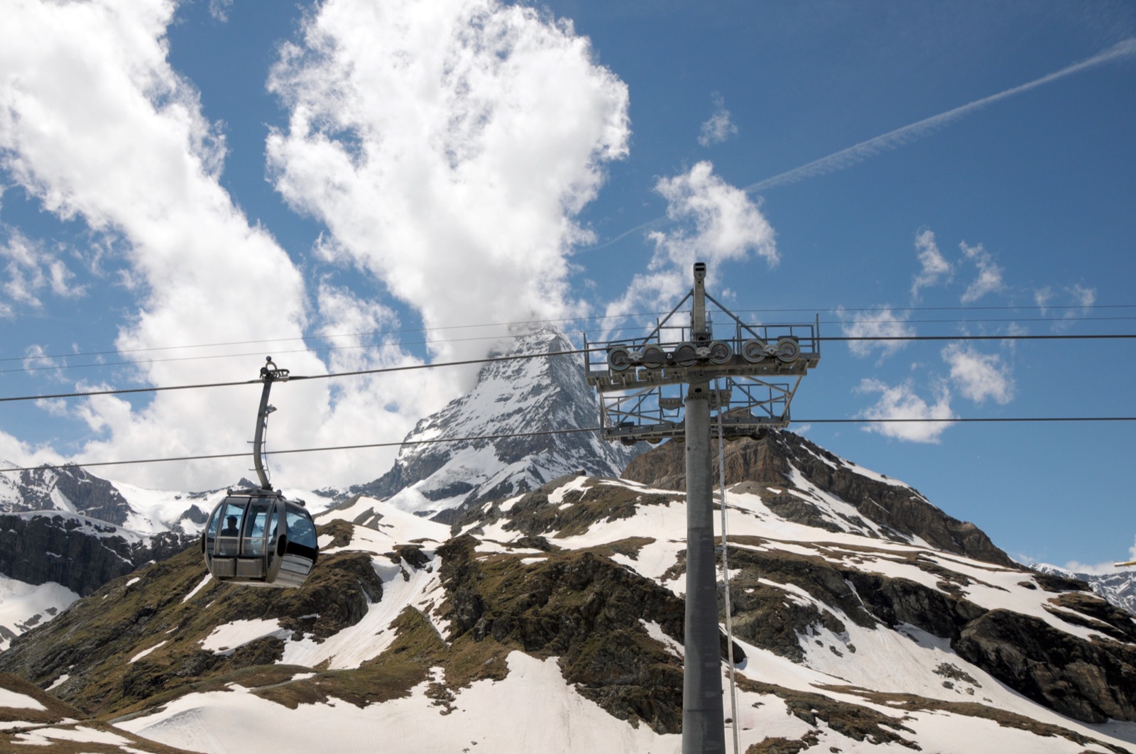
- Trockener Steg. At 2,939 m on the cable car to Glacier Paradise, the east face rises above the Furgg glacier, framed by the Furgg and Hörnli ridges.
- Schwarzsee. The north face and the Hörnli hut, with the mountain rising almost vertically above the lake.
Our guide to Gornergrat or Glacier Paradise compares the two main viewpoints, and getting to Zermatt covers the trains and the car-free village. Guided hikes and lift tickets are listed on the tours page.
Frequently asked questions
Can a beginner climb the Matterhorn?
No. Guides expect you to have climbed several 4,000-metre peaks, to be confident with crampons and an ice axe, and to climb rock up to grade III. Kilimanjaro or Mont Blanc by the normal route is not enough preparation, because neither is a rock climb.
How long does it take to climb the Matterhorn?
Two days. You walk to the Hörnli hut at 3,260 m on the first day. On the second, the ascent from the hut takes about 4 to 5 hours and the descent at least as long, so the whole summit day is about 8–9 hours.
Do you need a guide to climb the Matterhorn?
Zermatt Tourism lists a guide as necessary and the hut always recommends one. Some people climb without a guide, but Zermatt Tourism estimates that about 65 per cent of unguided climbers turn back.
How many people have died on the Matterhorn?
Zermatt Tourism estimates about 500 climbers died between 1865 and the end of the 2011 summer season. Four of them died on the descent from the first ascent, when the rope broke.
Can you visit the Hörnli hut without climbing?
Yes. The Hörnliweg from Schwarzsee takes about two hours and is graded demanding (T4), with exposed sections and metal staircases. The hut serves lunch from 11:00 to 15:00 in its summer season.
Where can I see the rope from the first ascent?
In the Matterhorn Museum - Zermatlantis in Zermatt, which displays the original rope that broke in 1865.